Tuesday, December 14, 2010

2011: Keep the Fun Going


"Age wrinkles the body. Quitting wrinkles the soul."- Douglas MacArthur


Last year my main goal was to start having fun with running again. I quit worrying about logging a certain number of miles and began running where I wanted to and when I wanted to. I was a much happier runner and that remains my main goal for 2011. I also have some specific goals, but before I can work on any of them, my IT band has to heal. It's getting better, but I'm only up to about 3 hours at a time. : (

2011 Goals:

1. Get the IT band healed in time to do a 50K at Nantahala Fria
2. Bartram under 39 hours
3. SCAR under 24
4. Massanutten under 32
5. Foothills under 24
6. NMAR under 32
7. 100 at Woods Ferry
8. 100 plus at Black Mountain
9. finish the 900 miles of trails in the Smokies
10. Keep running with Tony and maybe get an adventure race in.

Happy New Year!

Sunday, November 14, 2010

Bartram Trail Thru-Run

Short Story: November 11th, 2010. I ran the 110 mile Bartram Trail in NC and GA straight through, starting at Cheoah Bald and finishing at Russell Bridge. My husband, parents, and friends Alan Buckner, Scott Brockmeier and Liz Bauer helped crew and pace me. The weather was great, the trail was beautiful and it was an incredible challenge. I ran with a cold and injured my IT band in the last 25 miles, but pushed through it and finished in 44:36. The profile map is from www.parkaymaps.110mb.com


Background

In 2003, I ran my first trail race, the Nantahala Outdoor Center Bartram Trail Challenge, a 21 mile run starting at the NOC put-in and climbing to the top of Wayah Bald. The race was held in January and featured crossing the Nantahala River in the first few miles. That was my first big challenge and it is altogether fitting that almost 8 years later, my newest greatest challenge was running the entire length of the beautiful, but difficult 110 mile Bartram Trail.
This year, as I began to focus less on racing and more on adventure runs, I began thinking about the Bartram. To my knowledge, no one had been able to successfully run it from end to end. I thought about a summer attempt, but after running a few sections in the high heat and humidity and discovering how overgrown some sections had become, I decided to wait. The Bartram Trail folks cleared several sections of blowdowns over the summer and I took a hand saw with me on runs and cleared out whatever else I could to make the attempt as easy as possible. I decided to try it in November, after the first frosts, but hopefully before snow and ice set in.
I ran sections I had not done before or did not remember clearly and decided to run from north to south, to get the worst part out of the way in the first half of the run. I feel like I trained well and prepared effectively. I ran a number of long semi-supported runs this year (105 at NMAR, 77 at Foothills, plus several races 40-90 miles). As I ran sections of the Bartram, I carried as much weight as I could get in my pack to help strengthen my climbs. My mom and dad agreed to help support me, along with Tony, and Alan was going to run it as well. A few days before the run, Scott Brockmeier and Liz Bauer, ultrarunners extraordinaire, offered to come help, too. The long range forecast looked great and everything looked like it was working out perfectly…until I got sick a week before. I still felt bad the night before the run and was on the edge of cancelling it, but everything had come together so nicely, I decided to give it a try.

Stecoah to the Put-In
Alan met me at my house at 4:30 a.m. and we drove to Stecoah Gap near Robbinsville to start the run. The Bartram Trail rather inconveniently begins/ends at Cheoah Bald, which is 5.1 miles from the nearest road. We decided that of the options available to getting to the start, we would take the Appalachian Trail from the north, for 5.5 miles. It was a long uphill climb, but we took it slow and easy. At 7:50 a.m., we topped out at Cheoah and then started down the exceptionally steep first leg of the Bartram, the 5.1 miles down to the Nantahala River. The leaves were treacherous the entire run, especially on these steep descents. The Bartram is not heavily used and a thick layer of loose leaves covered up rocks and roots and turned the trail into a slip and slide.
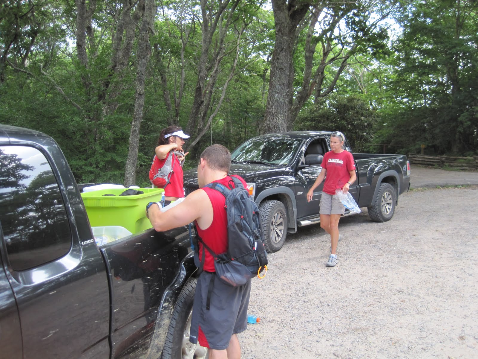
Put –In to Lakeshore Store
Mom and Dad helped crew for the first time and met us at the power plant. I was already feeling not all that great after only 10 or so miles. Alan and I left and began the climb up the mountain, where I told him to head on, as I was having issues. I sat down for a couple of minutes to allow him to get far enough ahead so the dust from the leaves wouldn’t aggravate my asthma and make me feel even worse. I was feeling light-headed, dizzy and lethargic. I trudged on uphill, and when I blew my nose, discovered I had a nosebleed, which has never happened during a run before. After getting that under control, I continued on, feeling miserable. At Appletree Campground, Mom and Dad were waiting along with Alan. I sat on the tailgate of the truck, deciding whether or not to head on. Dad reminded me that the trail would still be there and I could try again. After eating a cold hamburger, I felt a bit better and told Alan I would go to the Lakeshore Store, since it wasn’t a difficult section and then decide from there. On the way over, he and I decided we would end the run there and try again another day.
As we got closer to the store, Liz and Scott came running up. They had camped up near Wayah and had run down the mountain to find us, so I told Alan I would head on up at least to Sawmill Gap with them. Alan I think probably hated me at that moment, because he was feeling bad and planned to lay down in the back of dad’s truck, but instead we were going to do the most difficult section of the run, a nearly vertical climb from Nantahala Lake up to Sawmill Gap. Alan and I climbed slowly but steadily, with Liz and Scott following us up. A mile or so from the end, Alan’s projectile vomiting episode one occurred, right on cue (usually somewhere around 25 miles) and when we hit the gap, he decided to stop.


Wayah to Wallace Branch
Tony was there, along with mom and dad, and I decided to head up to Wayah, since Liz and Scott had come all this way and were camped up there. Once I hit Wayah, I decided that I might as well head down to Wallace Branch. Liz and Scott would meet me down there and run with me to mom’s house if I decided to go on. Alan was feeling better and went with me to Wallace Branch,
the first night section of the run.
This section was very difficult. It is very steep, with no switchbacks and was very deep in leaves. Despite the fact you are travelling down over 3000 feet, there are many extremely steep uphills in this section as well. It was beautiful, however, as you follow ridgelines and have an extraordinary view of the lights of Franklin on one side and of the valley where I live on the other. The sky was crystal clear and the stars rivaled the lights below. Unfortunately, Alan experienced PV#2, but recovered and we successfully made it down to Wallace Branch, where Tony, Liz and Scott were waiting. I decided to head at least to Mom’s house, about 5 miles down the road section . I had been concerned about running on the 14 mile road section, alone at night, but Liz ran with me with Scott following behind in the car. I enjoyed this section, as I have never spent time with Liz and running on the road was so much easier after what I had already done. The conversation made time go by fast and we were quickly at my parent’s house. I packed up my pack, changed clothes and we headed out again. Liz finished out the road section with me and then accompanied me up the mountain to Jones Gap.

Buckeye Branch to Hale Ridge
The climb to Jones Gap is the longest of the run. It is very narrow, rocky, leafy and steep. I was feeling bad as we climbed and midway through I decided that my virus had finally got the best of me and I would finish my run out at Hale Ridge Road, completing the North Carolina Bartram. Liz was very encouraging, but when we got to Jones Gap, I announced I was done, right then and there. I felt awful and didn’t want to face the next section, which featured the climb up Scaly and the roughest footing on the trail. Scott had been sleeping in his sleeping bag in his running clothes and was planning to run the next section with me. The sun was just starting to come up and I ate another cold hamburger. Scott didn’t seem to be really giving me the option to quit, so I told him I would run the next section with him (as if I were doing him a favor). He knew that the sun coming up would make all the difference, and of course he was right. The miracle hamburger worked, and off we went. Mom and Dad were meeting us at Osage Overlook, where I figured I would stop. Again, good conversation helped the time go by and distracted me from the climb up Scaly. We talked about Liz and Scott’s incredible 200 plus mile 48 hour race earlier this year, which made me feel a little bad about wanting to quit.
At Osage, I decided that since I was only 4 miles from the NC/GA line, I would go there and stop. I ate a donut that Mom brought and Tony showed up right before we left, which made me very happy. Scott would run to Hale Ridge with me, where everyone would meet us.

Hale Ridge to Warwoman
I had decided that Hale Ridge would be my stopping place, because after Hale Ridge, there is no crew access or dropping out for 18 miles. I had felt so bad earlier, that I knew I should have postponed my run. If I started out on the Georgia section and got sick again, that would be bad. However, Scott used logic on me and convinced me to continue on. He said that I was still moving strongly, the weather was great, and I had great support and those elements wouldn’t come together like that again. He and Liz would run with me and carry much of what I needed, so all I needed was my pack with water. Fine, I decided. They really need to see the view from Rabun Bald, so we would head that way.
The day was beautiful and although I wasn’t burning up the course, I was moving steadily. I made the climb up Rabun Bald and was glad that that was the last really long climb. Scott and Liz continued to distract me with conversation and our limited repertoire of jokes and time went by quickly. On the backside of Rabun Bald, however, the outer back side of my left knee began hurting. I continued on, but the downhills got more and more difficult. The day went on and around 4:30 or so, we came into a valley, where the sunlight was golden, illuminating a forest of beautiful fall leaves. The reds, oranges and yellows were so spectacular that I forgot my fatigue and pain for a bit.
As we got to Warwoman, however, the pain had become excruciating. I could go uphill and level fine, but downhills were undoable. I tried to gut it out and forced myself downhill, but it was like there was a knife in my knee. I hopped/slid/hobbled down to Warwoman and spent a bit of time crying on Tony’s shoulder. I had come so far and was only 18 miles from the end. I was moving good, feeling fine, but my knee wouldn’t work.

Warwoman to Russell Bridge (with one knee)
Liz and Scott gave Tony some tape and Alan had some Biofreeze. Tony taped my knee and I decided I would head out and see if that helped any. The first mile or so is uphill, which I could do, although I was now hobbling some on uphills and flats. The first downhill, I was able to sideways shuffle down, which was extremely slow, but I could make forward progress. I decided to try the six-mile section to Pool Branch Road. Liz and Scott stayed with me, although I was now mainly power-hiking, as running in any form was hurting my knee. The downhills had become almost undoable again and very, very slow and unfortunately, there is more downhill on this section than uphill. I decided though, that I would do everything I could to get to the end. Others will finish the Bartram much faster, but my Bartram Challenge will make everyone do the last 18 miles on one leg.
Tony met me about a half mile from Pool Branch and helped me down the steep narrow trail. I walked backwards, which did not hurt and he held my hands and guided me. After warming up and reloading my supplies, Liz, Scott and I took off to Sandy Ford, another 3 miles down the trail. The first part was a steep climb, and my knee was not hurting as badly. When it leveled out some, I was able to shuffle-run for the first time in hours. When we hit the downhill, I was able to use both legs, rather than dragging the left one. I wasn’t pain free, but it was not excruciating anymore. Walking backwards must have stretched or rearranged something in there.
At Sandy Ford, Tony decided to go with me. My knee was feeling better, but I was feeling bad again. I was cold and we had to cross a creek and then the lights were bothering me and making me nauseous. When we got to Earl’s Ford and into the truck, I was shivering uncontrollably, nauseous, and extremely fatigued. I had been running for over 40 hours and had a seven mile stretch left. I have never run longer than 37 hours or 105 miles and I wasn’t sure what my body was doing. Before I (or Tony) could think about it, I left. I stuck a couple things in my pocket and grabbed a water bottle. Alan was “running” this section with me and I took off before he had gotten his stuff together. We were along the river when he caught up to me and I told him I needed him to get me through this section and get me away from the river as quick as possible because I was so cold and still shivering despite having three shirts and a shell on. He took off up the hill and I followed.
I was so tired that I focused on bodily functions to get me through. First I focused on getting warm. I pushed hard uphill and did little shuffles to generate heat. Then, for awhile I focused on my nausea. I backed away from Alan some, so I could shine my lights farther and hopefully not continue to be motion sick. After that, I focused on my fatigue. Okay, so my fatigue focused on me. I yawned uncontrollably, and walked several steps at a time with my eyes closed. It got to the point, that I had to stop to yawn because I was afraid I would fall off the edge of trail. Then I focused on trying to keep my eyes open. I tried to look at the woods around me, but Alan would think I had stumbled off the trail when he saw my light shining in the woods, so then I began looking at the leaves in the trail and focusing on following the reflective markings on Alan’s back.
This section took forever. My knee still hurt, so there was no running, and it was getting pretty sore on the downhills again, so it was slow going. It felt like we were going in circles and I tried not to think about how much farther we had to go. When we hit the river again, I got very cold again and Alan gave me a space blanket, which improved my mood dramatically. I was warmer, knew we were getting closer (although not as close as I thought), and I felt like one of the old stove-top Jiffy Pop popcorn aluminum foil containers. (Hey, I had been awake for 48 hours at this point).
Finally, I saw Tony heading down the trail towards us and knew I was almost done. (He had walked out the trail and heard two mountain lions screaming and coyotes howling on the ridgeline between him and where we were. If I had heard it, I would have assumed I was hallucinating).
The finish was non-eventful. Liz and Scott had been sleeping while waiting and gave me a hug. Alan took a picture and we all climbed into vehicles, exhausted. I had run with a virus, a nosebleed, nausea, and an injured IT band to cover 110 miles of the Bartram in an excruciatingly slow 44: 36. I had been awake over 48 hours, moving for 47 of it, including the initial 5.5 miles to get to the Bartram. I’m going to leave the 24 hour plus runs to Liz and Scott and I’m going into groundhog mode for the winter. (Building up some body fat and doing a lot of sleeping).
In retrospect, postponing at least one day would have been smart. Still being sick made me weak which made some sections very slow, and I spent a lot of time at “aid stations” trying to rest and regroup. Pushing through the bad IT band was not a good idea, either. I had thought it would take around 40 hours and if I hadn’t had to do the last 20 miles at less than a 2 mph pace, it would have. However, unlike the Foothills Trail, I still love the Bartram and although I don’t feel the need to do another traverse, I will be back out soon running on it.

Friday, October 1, 2010

Foothills Trail Traverse

Last month at Laurel Valley, as I was struggling up Whitewater Falls, Byron Backer mentioned the upcoming Foothills Traverse that Jason Sullivan and friends were doing. I had planned to go along with Jason’s group on their first attempt , but still recovering from NMAR, I reconsidered doing a 77 mile run in the foothills in July. Although my response to Byron was, “that would mean I would have to run this section again” which was sucking pretty bad at the time, I did start thinking about it.

In the end, I signed on with Jason’s group and began getting ready. I’m not sure what Jason does for a living, but if it does not involve planning and organization, he has missed his calling, because I think it was the best planned “fun run”that I have done.

To get to the point, I met Jason, Psyche, Charles, Scott and Byron at Table Rock State Park at 7pm Friday night. Byron had generously offered to help the crew the adventure and although I originally planned on starting earlier, I waited until 7 so I could take advantage of knowing Byron would be at some of the trailheads, since I was going to be running solo. This would be the first time I had done a night section solo and I was a little nervous about it. At 7:08pm, I shouldered my pack, carrying enough to support myself for the first 47 miles. If only I had packed more batteries.

The first part of the trail is a well-used route to the top of Pinnacle Mountain, an open rock face with a spectacular view. At least it was spectacular that night. The lights of the cities glowed in the valley below, while above, the full moon was rising out of the clouds. The lights below reminded me of the section of Hellgate, where I have looked down and imagined all the normal people in the world, home safe and comfortable in their beds. Everyone was together here and spent a few moments admiring the sight. I took off, wanting to get some miles down, but a half mile down the trail, I came within one stride of stepping on a copperhead crossing the trail. He curled up next to a log on the edge of the trail and had no intention of moving on. So, I waited a few minutes for the rest of the group to make sure they avoided him. After that, I quit running so fast downhill that I couldn’t see what was coming up in the trail. I ran for about a half hour with Scott, but then was alone for the rest of the trip.

That brings us to….

Rookie Mistake #1.

Not packing enough batteries. I’ve run enough at night to know better. I have no explanation for my actions. As uncomfortable as I was about running solo at night, I would have thought I would have carried several pounds of extra batteries. I was using different lights and a different system and what worked in the past did not work this time and I was unprepared.

First, I bought a new Black Diamond Spot and used the batteries that came with it. The package said it would run 50 hours, so I figured I would be good to go for 11 without any problem. I wore that as a headlamp. Then I borrowed a Spot to use as a handheld and knew that only two of the three batteries were fresh, but for some reason I did not replace them. Then I wore my Petzl on my chest strap to give some diffused light and kept it running all the time. I brought 4 spare lithium batteries. The system worked really well…for a while.

Four hours in, the handheld started to die, which did not surprise me. I replaced the batteries and took off. An hour in, the headlamp grew dim. So much for 50 hours and now I only had one extra battery. I turned it off to conserve whatever power it had left. When I did that, I noticed my Petzl’s indicator light was orange, warning me that it was low on power. So I turned it off, too. I had about seven hours to go and one light with fresh batteries. How long would it last? I had no clue, so I switched it to the dimmer mode. I figured I would use each light until they all died and then build a fire and wait until dawn. I couldn’t move too fast with a dim light, but it was better than wasting time by not moving at all. The full moon was not any help under the canopy of the trees.

In the middle of the night, as I approached a place where the trail intersects with an four-wheel drive road, I saw someone standing there hollering at me. Great, I thought, I’ve crashed a party. Hmmm…maybe they have batteries. But instead, after the man ascertained that I was not a homicidal maniac, I learned that a family had come out there at midnight, gotten a flat tire and was mad at 911 because a tow truck had not yet arrived. They believed they had been left for dead because it had been two hours and and before they decided they should keep me in case they started to starve to death, I made my escape. I figured they probably didn’t have any batteries.

I have seen many bears and even more wild hogs (who were much more aggressive) out on my runs and I didn’t feel the need to run silently through the night alone, hoping to have wildlife encounters. I turned on my external speaker on my Ipod, let my bear bell jingle some (not too much- way too annoying) and promptly scared away anything within a half mile, especially when I started singing along to “Crazy Train”. The system worked very effectively on a skunk, who I smelled long before I found him, running away from me with his tail straight up.

However, as a result of my light situation, I moved a lot slower than I intended and I made myself motion sick from using only one light. When the sun FINALLY came up, I was nauseous and walked the final three miles or so up to the top of Whitewater Falls. The heat and sun had really cranked up and the final climb to the car was pretty rough.

Byron was waiting there and he told me I still had a shot at 24 hours, that I would get feeling better and start running again. I did get to feeling better (ginger chews and spaghetti-o’s) , but I was already at least an hour behind of where I expected to be. I loaded up with enough supplies to last me to Oconee and was off again.

The next couple of sections were nice. I was moving fairly well and the trail was actually pretty nice and scenic. That brings us to ….

Rookie Mistake #2. Not studying the map and not having clear directions to the trailheads. Tony was going to meet me at Burrell’s Ford and walk out on the trail some and meet me. When I got to Burrell’s Ford, way ahead of when he expected me, the truck was there but Tony was not. I found Jason’s car and retrieved the best-ever ginger ale out of his cooler and tried to figure out what to do. I wanted some things out of the truck but it was locked and I was worried that Tony would not know that I had come through and would sit there waiting for me. As I stood there a while debating what to do, Tony came back. He wasn’t sure which direction I was coming from on the trail and was looking for me. I grabbed some things and took off, but I couldn’t tell him where the next trailhead was. He was just going to look for where it crossed 107.

The next section sucked and this is where I started to have a mental meltdown. I felt like I was moving pretty fast for as rough and rooty the trail was. I came across a mileage sign which indicated I was moving at faster than 3 miles an hours, faster than I thought I was, so as the trail improved, I know I was running faster. But I didn’t know how far it was to the next trailhead. After two and half hours, I was sure I would be there any minute. Every time the trail changed (moving away from the river, turning back toward the river, climbing a ridge, passing campsites), I was positive I was there, but the trail just kept going and I had one letdown after another. Then I found another sign that indicated I still had a long way to go to the trailhead and I was crushed. I thought I was making really good time, I was running hard, but I was going to end up running in the dark again. And would Tony find a trailhead? Would he worry because I was so late? I really wanted to sit down in the middle of the trail and cry. At that moment, I looked up the trail and there was Tony. He had hiked in about four miles to find me. It didn’t matter then how much farther it was and how much longer I had to go, I was just so glad to see him. We hiked out together to where he parked the truck, 4.6 miles from the finish.

Twenty-four hours was not going to happen, but if I could cover the 4.6 in about 70 minutes, I could finish under 27. I finished SCAR in 26 on a bad day and I would be darned if I was going to finish this in 27. I ran hard and once again got so frustrated that it was taking so long. I sprinted the last part, finally finding that sign that marked the end of my adventure, 26 hours 58 minutes later.

In my final analysis, SCAR was much tougher physically and the Foothills was tougher mentally. I will go back and do SCAR again. I have no further interest in the Foothills.

The mistakes I made that cost me the 24 hour mark were:

1. Not packing enough batteries to make good time at night and then making myself nauseous so I lost even more time.

2. Between the trailheads at Whitewater Falls, Sloan Bridge and Burrell Ford, I wasted well over an hour regrouping. At Whitewater Falls I was trying to get my nausea under control and once I knew 24 hours was not going to happen, I was a little more leisurely.

3. When I was not where I thought I was after Burrell’s Ford, I gave up mentally for a time. I didn’t care if I ate and I didn’t care if I ran out of water. I didn’t care if it was time to use my inhaler. I didn’t care if I finished in 24 hours or 48. Tony finding me gave me the mental push to finish.

I really appreciate all of Jason’s planning and help, Byron’s crewing and encouragement, my mom coming to help get my car back home, and Tony rescuing me once again. Both Scott and Psyche also successfully finished and I am looking forward to reading their stories. Now that I know I can run in the dark with very little light, I can tackle even bigger adventures.

Monday, September 13, 2010

Long Cane 50+++++ Miler


“How long can a 50 miler take?” was Tony’s text message to me when he had not heard from me when he expected to. Unfortunately, today it was 12 hours and 32 minutes, MUCH slower than any of my Masochist times. How could that be? It turns out that Horton miles are nothing compared to Hayes miles.

Long Cane is the fourth race in Terri Hayes’ South Carolina Ultra series. Terri has bucked the trend of high priced races with tight cutoffs and time limits. She does not charge anything for her races, but accepts donations instead. You don’t get a t-shirt, but you do get a unique handmade finisher’s award. Her races are extremely well organized and have better aid than many races I have run. You don’t feel any pressure in her races and you know that no matter how long it takes you, Terri is not going to pull you off the course. In addition, Terri manages to find interesting places to run and I feel like I have been on a Tour de South Carolina this year.

I drove down the morning of the race to Parson’s Mountain Recreation Area south of Abbeville, South Carolina, about 2 hours and 45 minutes from home. I was glad I had TomTom, as the trip required a lot of turns in order to arrive right smack in the middle of nowhere. Okay, maybe not as far in the middle of nowhere as Woods Ferry, but pretty far out.

After checking in and picking up a race packet (you get free stuff despite not paying an entry fee), Terri explained the course. You would run the trails first in a figure 8 pattern and then run the outer loop back to the finish. It made sense when you saw the map. After the race briefing, Terri simply said “go” and off we went.

The trail is a meandering single-track multi-use trail (mountain bikes and horses), but is in good shape. Unlike Woods Ferry, the trail was generally non-technical and flat. Okay, it rolled some, but the hills were so short that I felt compelled to run them all for the first three hours. Soon I realized that that strategy would not work for me. I am not very speedy on flat terrain and I usually rely on steep descents to make up time that I lose on uphills. I have no clue how to run when everything is so runnable. I don’t know how to actually pace myself, since the mountains usually dictate what pace I go.

As the day wore on, I began taking walk breaks on the hills and taking it easy in the hot sun. The weather was great for the first three hours, very fall-like, but the temperatures climbed quickly once mid-day arrived. The humidity stayed low, but it was still hot. I was also having trouble with my asthma. I got to one aid station and found that I had almost lost my voice. The culprit was the dust. It was very dry and you could see the dust hanging in the air. Once I figured that out, I tried to stay away from other runners and my breathing improved some.

Howver, about halfway through I became very concerned about my time. At aid station 5, they said it was four miles or so to the next aid station, the turn around point. I didn’t pay too much attention to the time, but it looked like I was running twenty minute miles on a section where I didn’t take too many walk breaks. It turns out that there were a couple of extra Hayes miles on that section, and when the race was over, runners’ GPS’s read that it was a 57 mile course. It was not Terri’s fault that it was so much longer, she was simply going off what the Forest Service map said the distance was. A lot of runners opted to stop at the thirty mile mark rather than continuing on. Thirty-two of the original 62 runners finished the 55 mile (as Terri is calling it) and others finished at distances ranging from 50K to 50 mile.

As I realized how long it was taking me, I began to get a bit frustrated with myself. Luckily, towards the end of the race, I ended up running with other people who took my mind off the time of day. I ran a section with Andrew, who was battling an IT band injury, and another with Orran, who had missed a turn and was going to end up short of 50 miles. One gentleman had lost toenails and was bandaging them up at an aid station when I came through. A few minutes later, he came sprinting past me, hollering like a banshee.

Although it made me feel a bit better about my slow time, I realize that I either need to stick to the mountains or figure out a way to train on flat ground. I jokingly complained to Terri about her flat course, but judging from how sore my legs are two days later, I apparently got an excellent workout using my muscles in a way they aren’t used to.

Despite my dislike of flat, hot places, I will go to more of Terri’s races because she does such a nice job of directing these runs. Hopefully she will continue to get enough donations to continue to do this.

Thursday, August 19, 2010

Laurel Valley #7: It’s the Humidity

At the finish of Laurel Valley this year, I told John Teed I still curse him on occasion. In 2003, I got an email from him about ultrarunning. I did not know John and he did not know me, nor did I know anything about ultrarunning. After discovering that email wires had gotten crossed, we began a conversation that led to me running ultras, specifically Claude Sinclair’s ultras. That year I ran three of Claude’s runs, Crowder’s Mountain, the Double Shut-In and Laurel Valley before tackling the Masochist and Hellgate. So, when I am having a particularly bad time, which usually occurs at some point during Laurel Valley, once in awhile I remember who got me into this mess.

After I ran Laurel Valley that first year I have only missed one, due to an injury. It’s not because I love Laurel Valley, in fact I actually dislike it, but there is something special about the run and I know I would regret opting not to run it. It’s hot. It’s humid. It’s in the foothills, rather than high elevation. Yellow jackets try to sting you. There are a lot of annoying stairs. The course seems to blur together in my mind so I always think I am a lot closer to the finish than I really am. And then there’s the final climb as you try to crawl your way through the clean-smelling tourists who look at you strangely, as if the climb from the bottom of the waterfall can’t be all that bad. Despite all that, I keep coming back.

This year’s run was pretty uneventful for me. It was extremely humid and I had a tough time about 3 hours in. My clothes were soaking wet and I felt very tired and a little nauseous, but about 4 hours into the run, it started raining and my run and my attitude improved significantly. I did not get stung by yellow jackets this year, I did not pull a hamstring, I finished faster than the last two years (although way off my PR) and I got to see a lot of old and new friends, so all in all, it was a good run.

Course Description:

Laurel Valley covers 35 miles of the Foothills Trail. First the first few years I ran it, the distance was disputed and Claude even had his sweeps try to measure the course with a wheel, but the counter fell off somewhere along the way. Now we know it is 35 miles, but it always feels a lot farther.

The race starts in the dark in the Laurel Valley parking area, near Rocky Bottom, SC. Claude starts the race by firing an antique firearm and off you go. You start up some steep steps and then run on some tight, rooty single-track, rolling mainly uphill, for the first 30 minutes. Then the sun comes up and the trail opens up and for the next couple of hours, the trail is nicely runnable, alternating from single-track to double-track, running along a stream and past waterfalls, before you start some climbs. The lake comes into view and then a particularly tough section starts, consisting of a series of very steep stairs. I think it is 5 climbs before you hit the downhill, which is also a lot of steep and precarious stairs. For some reason, I always fill up my water before this section so I have the added pleasure of carrying a lot of extra weight. You run along the lakeshore briefly, before heading across a long swinging bridge and some more steps.

The next section gets pretty monotonous. It is an old forest road that rolls and twists and turns and everything looks the same. There is a long, steep climb near the beginning of this section, but the run starts to get fairly blurry at this point. There are a couple more bridge crossings and a nice section where you leave the old road for awhile and run along a stream on single-track. About two hours from the finish, there is another set of 51 steep stairs to climb, which I always use as an indicator of where I am. Then you are back to more double-track, more steep climbs, interspersed with some sections of single track. About an hour from the end, there are some signs for camping areas, etc., (ignore the mileage signs) and you head down to the river, parallel it for awhile, and then try to get across it safely by climbing up and down some boulders. The last part consists of a very steep climb with a lot of stairs from the bottom of Whitewater Falls to the parking area at the top.

The race is totally self-supported with no opportunities to drop out along the way. Claude’s races are pretty low key, but he always has the runners’ safety as his priority. He has a well-organized system of sweeps to make sure no one is left out on the course and only veterans are permitted to run it. (First-timers can sweep). Although there is no aid along the way, there is plenty to eat and drink at the finish along with a nice t-shirt.

Wednesday, July 21, 2010

NMAR 2010


The A.D.D. Version:

105+ miles on the Appalachian Trail

19,000+/- of elevation gain

36:08 hours

1 wonderful husband

3 great friends

1 former student

3 wild hogs

1 set of BIG bear prints

1 creepy old guy with a gun

Who knows how many GUs and Chomps

4 monster blisters

2 days of good air quality

3 face plants

1 injured ankle

1 brief cry on Tony’s shoulder because I was just so darn tired

0 Hallucinations : (

6 episodes of What You Missed in History Class

1 prayer answered

1 monkey off back

The Nantahala Mountains Adventure Run is a Denise Davis creation, filling a void in my running calendar. The course description is in the previous post, but, briefly, it is an out and back on the Appalachain Trail, from the Nantahala River to Deep Gap in Standing Indian and back. The run was semi-supported with some aid along the way, but I was mainly responsible for finding water and carrying enough supplies to last me up to twelve hours. Just a fun weekend adventure!

The Long Version

“I can’t do the 100 in two weeks,” I told Tony after a training run. I had gone to run the AT from the Nantahala Outdoor Center 11.5 miles mainly straight up to Cold Springs shelter and back. The temperatures had been in the nineties that week and along with the heat came bad air quality warnings. After eight miles, the rest of the run became a struggle. If I could barely make it 23 miles, half of it downhill, I knew that a full 100 was out of the question. But lo and behold, a front came through the day before the run, delivering some rain and clearing out the bad air. The run would go on.

I started solo at the Nantahla OC at 6:20 Saturday morning, carrying six hours of supplies, and began the long climb. With the better air quality, I was able to make faster time than expected, despite intentionally going slow. I wasn’t concerned about how fast I finished, I just wanted to finish. After enjoying the view at the Jump Up, I continued on, refilling water at Wesser spring and Burningtown Gap. Shortly after Burningtown Gap, Sarah Lowell called to find out where I was. She and Katharine Brown had just returned from the trip out to Western States and wanted to join in on the adventure. They decided that they would take turns running some sections with me, so they met me at Wayah Bald and Sarah kept me company down to Wayah Gap. We talked about her WS adventures and our future running plans. I told her that the last 100 I finished was Grindstone in October 2008 and mentally, I really needed to have a good run. At Wayah Gap, Tony was waiting for me and I refilled supplies and headed up to Siler’s Bald. I was able to start carrying a little less until nightfall as access points to the AT would become more frequent.

A couple miles from Winding Stair Gap, both Sarah and Katherine met me on the trail, and Tony met me once more before heading over to Nantahala to fish and get some food. Katharine, a strong uphiller, joined me for the trek up to Albert Mountain, and we enjoyed all the colorful fungi on that section and noted how much wild hogs had torn up the ground in one area. Sarah met us a couple miles from Albert and after tagging the survey marker up top and enjoying the clear view, we continued down to Mooney Gap. Tony was there, along with Alan Buckner and his son, and Katharine. I took some time here, changing clothes, eating, and getting ready for the upcoming dark. Alan was joining me here to start the NMAR 100K and off we went to the turnaround point at Deep Gap. My feet started bothering me some on this section and I stopped a couple of times to relace my shoes. Dark set in on the long climb up Standing Indian, and shortly after, we were serenaded by a pack of coyotes barking and howling down in the valley.

Shortly after 10 pm, we arrived at Deep Gap, where Tony was waiting. We had decided that he would drop a cooler with supplies at Rock Gap and go home and sleep. So we loaded up with around 12 hours of supplies, in case something happened to the cooler, and headed back up Standing Indian. I stopped to doctor my feet and discovered I had developed blisters on the balls of my feet and the sides of my heels. I usually don’t blister, so I am not sure what I did differently. The trail was certainly rocky and rooty, and I think I may have left my laces too loose early on. The blisters slowed my pace, as I negotiated the rough trail. Once we got back to Mooney Gap, we opted to add about 1.5 miles by taking the gravel road to Albert Mountain, rather than the trail, to give my feet a break and avoid some dangerous sections in the dark. Back on the trail, my energy was good, but my feet slowed my progress. We made it to Rock Gap shortly before six, as the sky was starting to lighten up. We located the cooler intact, but also an armed strange person from Georgia who thought we were looking inside his minivan, several feet away from where we were sitting, repacking our packs. After getting tired of dealing with “John,” who had been sleeping in his vehicle, who was from “lots of places” and who “didn’t fall off the turnip truck yesterday,” we opted to take the paved road up to Wallace Gap, avoiding a short but rocky section of trail. (On a serious note, at the first Nantahala Fria, Sarah got behind a slow moving minivan, which most likely contained the killer of two hikers in Brevard and one in Georgia. Shortly after NF, the body of one of the Brevard hikers was found a half mile from the entrance of Standing Indian. ) I texted Sarah, to see if she was awake and would want to bring us some food (and to warn her to watch out for the weirdo) and she agreed to meet us at Winding Stair Gap. After a steep climb, we came back through the area where the wild hogs were still active, and there they were, plowing up the ground. We all startled each other, but Alan and I stuck to the trail, whereas the hogs bolted down the side of the mountain.

The next section was the climb up Siler’s Bald, which I can usually run in under an hour. I’m not sure how long it took, but it was very slow. My feet hurt badly, so we decided that we would add some distance once we got to Wayah Gap by taking the road rather than the rocky trail. It would also make it easier for Tony to find us, which he did shortly after we started up the road. I changed shoes and socks, ate an ice cream bar and part of a sandwich and then Alan and I headed down Wayah Bald and over to Tellico Gap. This was the worst time. I pulled something in my left ankle area, which really hurt on the downhills and in conjunction with the blisters (which were huge by this point), my pace was slowed to a crawl. I don’t remember the steep climb to Cold Springs being so long or bad, but it was. Tony ran out the trail to meet us on the other side and seeing him always lifts my spirits. It was getting hotter, I was fatigued and barely shuffling, but I only had one more section to go.

The climb to Wesser Tower was horrible and it took me twice as long as usual to make it. (Listening to podcasts of What I Missed in History Class distracted me some, but now I will always associate Wesser Tower with the Janissaries). From here it was pretty much downhill for six miles, but it was a lot steeper, rockier and rootier than I remembered on the way up. It took me longer to go downhill than it had on the uphill. About three miles out, I had a nice pick-me-up, when Daniel Hamilton, a former student who did a couple adventure races with me, ran out to meet me. I hadn’t seen him in awhile so it was a nice distraction to catch up with him and think less about the pain. Sarah met us a couple miles out, and as we neared the end, I could hear Katharine whooping and hollering. At the finish, they had strung out a finish line tape, had balloons on a walking stick (to help me get to the car), a card and a little goody bag they had put together.

36:08, 105+ miles. A personal best as far as distance goes. Alan finished the 100K in…I'm not sure! Sarah is interested in doing a ½ NMAR sometime soon, although I will try to talk her into the full thing. It will be fun to crew rather than run! (Tony laughed sarcastically at that, since I have never crewed, and apparently it sucks). Anyway, I actually wouldn't mind to do it again (although not this weekend...or this month...). If anyone else is interested and wants some help, let me know and I would be glad to assist you. You're on your own with weird guys and wild hogs, though.

Tuesday, June 22, 2010

Nantahala Mountains Adventure Run


What: A self-supported 100 mile adventure run traversing the Nantahala Mountains. It will be a 50 mile out and back on the Appalachian Trail with a VERY rough approximation of 18,000 feet in elevation gain.

Where: Start on the Appalachian Trail at the Nantahala Outdoor Center and head south to Deep Gap in Standing Indian and then back.

When: I plan to start Saturday July 10th 6am and to finish sometime Sunday July 11th, hopefully by 6pm. Alan Buckner is running the last 50 with me, starting at Deep Gap.

How: This is a self-supported unofficial 100 mile adventure run. The only aid/crew/rescue that will be available will be what you provide for yourself.

Options: 50 mile run, either having someone pick you up at either end or doing a key swap with someone who wants to go the opposite direction. Or you could run to Winding Stairs and back.

Rough Course description:

Mile 0: leave NOC, start long steep climb to the top of Tellico Bald (approximately 10 miles of climbing)
Mile 8: forest road crossing at Tellico Gap
Mile 10: reach Tellico Bald, short side trail to view, start downhill
Mile 14: Burningtown Gap (trivia: I live near the bottom to the left). Trail is fairly rolling until a steep climb to Wayah Bald
Mile : reach Wayah Bald, observation tower closed, but view still great. Road access. Start rocky section of trail, rolling and then downhill
Mile : road crossing
Mile : road crossing at Wayah Gap. Start climb up Siler’s Bald
Mile 23: reach Siler’s Bald. Steep climb to the right to the top, great view. Start downhill to Winding Stairs Gap
Mile 27: road crossing at Winding Stairs Gap (trivia: my xc team does the Silers Bald challenge yearly. If they make it from here to Siler’s Bald in under an hour, they get a t-shirt) Start uphill, then downhill, including steep rocky section.
Mile 30: road crossing at Wallace Gap, trail rolling
Mile 31: road access at Rock gap shelter, start long climb to Albert Mountain ( with short downhill section in the middle).
Mile 37: Albert Mountain Fire tower. Side trail to the right head to parking lot. Start exceptionally steep, rocky descent.
Mile: Road crossing at Mooney Gap. Next several miles are fairly rolling.
Mile 43: Carter Gap shelter
Mile : Beech Gap, start climb up Standing Indian.
Mile : Standing Indian, side trail to left to view. Start descent.
Mile 51: reach Deep gap

On the way back, for safety reasons, the course will avoid Albert Mountain and the rocky approach to Wayah Bald. The run will still be 100+ miles.

Albert Mountain by-pass: At Mooney Gap, turn left on the gravel road. Bear right at the intersection to climb to Albert Mountain. At the parking lot, take the trail to the right. There is another short side trail about 1/4 mile to the left that takes you to the AT. Turn left on the AT. (If you miss this last turn, the trail still intersects with the AT).

Wayah Bald approach bypass: After crossing Wayah Gap, you will interesect with a gravel forest road in about a mile. Turn right and this takes you to the tower. Find the trail behind the tower.


Tuesday, June 8, 2010

Black Mountain Monster 24 hour: It is what it is

This past weekend, instead of traveling to Old Dominion, I stayed close to home and ran the Black Mountain Monster 24 hour race, the successor of the Run For Africa and Blue Planet races. I was bummed at missing OD, as it is a special race for me. When I first met Tony, he lived in Woodstock and we worked the Mudhole Gap aid station. Running OD is like going to a reunion, seeing a lot of old friends and familiar faces.

I rode to the BMM with Sarah Lowell (training for WS) and Katharine Brown (pacing at WS). After I hauled all my gear, tent, etc., down steep stairs to the field, I found a lot of familiar faces here as well. This included Brian Bedhun, who had made a pact with me in the wee hours of Blue Planet that we wouldn't run around in silly circles again. Here we are, running around in silly circles.

The race started at 10 a.m. and it was already hot and humid. The high would reach 86 degrees and the humidity did not abate through the night. I'm not sure how many started, but the numbers were lower than the previous races, especially among the relay runners. As the day and the heat wore on, many runners cut their race short and at times, I felt like there were only a couple of other people on the course.

Course Description

The course was 100m short of 3 miles. I never got bored on this course, as every quarter mile or so, it changed. Double track to single track, grass to dirt to gravel to wood chips to pavement, fields to woods, etc. It was fairly flat for the mountains, just some rolling hills. The longest uphill was not much more than 100 yards long. There were lots of twists and turns and if you didn't pay attention, you were on the wrong part of the course.

My Race

After putting in a lot of training this spring, I felt like I could hit 100 plus miles. I was worried about the flatness, though, as I do much better on steep terrain and do not have a lot of flat areas to train on.

As always, lap 1 was a little fast, but I adjusted and decided where I would take walk breaks. After a couple of laps, I was able to run at a steady, consistent pace for the rest of the day. For the sake of full disclosure, though, I think I missed a turn as one lap was two minutes faster and I don't remember running through "Poison Ivy Patch." But I often zone out, so I'm still not sure. Anyway, I felt good all day, despite running in the the oven and I was pleased that I could put out even splits.

Then after 11 hours in, I began to have stomach issues. I tried adjusting my pace, what I was eating and drinking, but it never passed. Tony came to run the 12 hour night shift race and I did do 5 or 6 laps with him, but ended up walking the last two. Finally I stopped. Nothing I did seemed to work, and in the back of my mind was Blue Planet, where I pushed through nausea until at the end I couldn't walk to the bathroom. I have had stomach issues up until about two years ago when I figured out that the culprit was too much caffiene and sugar. With the exception of Blue Planet, though, the issues were usually post-race and did not interfere with my run. So I don't know what happened. I was having fun. I wasn't bored, I had plenty of energy and I was ahead in laps and on track for 100. I have thought about it and analyzed it for a couple days, but I finally just decided, it is what it is.

I came looking for the 100, but ended up with 72. It was enjoyable and I got to talk to a lot of people I have not seen in awhile. I got in a good 72 mile training run. Training for what, though?
Who knows, but I definately want to do more adventure runs this summer.

I would recommend this race. It is the first 24 hour I did not get bored at, and the race director and volunteers were all friendly and helpful and open to suggestions. Apparently I was not the only one who missed a turn, as the race director quickly ran out and put up some additional signage and markers early in the race. It was well marked at nighttime and they repainted some of the arrows that had been worn away during the day. There was aid halfway through the loops (water, Gatorade and fruit), as well as at the start/finish and porta-potties at both places. It wasn't the typical mega-choice ultra spread, but everyone had brought their own stuff anyway and pizza was delivered early in the evening.

I left at 4 a.m. and do not know the results, but was impressed with Annette Bednosky's 60 plus miles in the 12 hour and especially Anne Lundblad's 40 plus miles, which she walked in the 12 hours after having back surgery a few weeks ago. http://www.raceforawesomeness.com/?p=60

Monday, April 19, 2010

Woods Ferry 24 hour run: The Unexpected


This past weekend, I ran the inaugural Woods Ferry 24 hour run outside (way outside) Chester, SC. This is one of Terri Hayes’ races and one in which she was celebrating by running her age in 24 hours. This race, for me, was primarily an opportunity to raise some money for The Butterfly Fund (see earlier post) but to also banish some ultra demons that have been hanging around with me for awhile. I had not finished a 100 or a 24 hour race since Grindstone, almost a year and a half ago.


Course Description
The course was a ten mile loop, basically a figure 8 on a stick. The trails (like in northern Virginia) are named for colors and the sequence was purple, blue, yellow, blue, purple. That was a bit confusing, but once you did a loop, it was not difficult.
Most of the course was single track, with some double track, and about a mile of gravel road that you could opt for that paralleled a section which ran through a power line cut. The trail was pretty rough, with lots of roots, a few rocks, and a lot of hoof prints which had hardened in the mud. (The trails are used as horse trails). The terrain was very hilly, with very few flat areas. The climbs and descents were not long, but they were frequent. There were around four pretty steep climbs, but they were short, in comparison to mountain runs.
The day started off warm. Sections of the area had been burned, and some areas were exposed with no shade. There was a breeze blowing in some areas, but by midday, it was very hot. By mid-afternoon, though, there was some cloud cover, and it got pretty chilly at night.
The terrain and the heat made it a pretty slow course. My earlier prediction that there would be several 100 mile finishers would not hold up.

My run
It was another good day. I was very relaxed, and knew that for every mile I covered, I was making $8.20 for The Butterfly Fund. It was nice to see a lot of familiar faces and I enjoyed talking to different people on the first couple of loops. After that, everyone spread out and I spent the next several loops solo.
My energy level stayed pretty steady and whenever my stomach started to have issues, I just slowed down for a little while. I avoided a lot of sugar and caffeine and that seemed to do the trick. After the first loop, I settled into a pattern of what hills I would walk and I didn’t deviate from the pattern the whole race. I slowed down a little each loop, but remained between 2:00 and 2:30 all day, until my last couple of loops, when I was pretty tired and had already realized that nine loops would be the most I could get in under the time limit.
After the first two loops, I was having some issues with breathing, and I think it was because I was running with people and inhaling a lot of dust. After that, it was fine, despite the high pollen.
For the first time, I ran farther than 50 trail miles in my lightweight road shoes (Brooks Ravennas). After a couple of loops, my toes started to hurt some from the downhills, but I guess they got used to it and didn’t cause any more problems. I had figured I would need to change out of the shoes early on and switch to beefier trail shoes, but all I did was readjust the lacing at one point. After 90 miles, I have no blisters or sore spots.
The high point of my run was when Tony arrived at mile 70 and ran with me. He hasn’t run much in the past four years because of knee and other issues, but he has started to run a little in the past month. He has probably logged about 20 miles in a month, but still ran 20 with me this weekend. On more than one occasion, I would watch his light slowly disappear up a hill, before he realized he left me far behind.
I used 5 hour energy, gels and chomps, and ate “real” food at the aid stations. I ate a half a chicken sandwich a couple of times and cream cheese crackers went down really well (although are hard to eat and run). Powerade didn’t work for me, and the Heed tasted like I imagine a cactus to taste like.


My review
I had a great time. Terri Hayes made it a very low-key, relaxed event. Families came and hung out and even ran some loops with their runners. With the campground right next door, some people went and took naps and then came back to run more. Some events are rather tense with strict rules about what you can or can’t do, but this was more like a fun run atmosphere. The aid station workers were all extremely helpful, including the cross country team that manned the outlying aid station. Although I dislike running in circles, the ten mile loop was not bad, and the figure 8 format, with the different trails linked together, kept it from getting too monotonous. You had the opportunity to see different people at different parts of their run, and it was nice to see the race director out there getting her birthday miles in in the middle of the night. I wouldn’t change anything about the race, but I would recommend making sure you have everything you need before you head there. I think the closest pizza place was over an hour away.


What was unexpected
1. The location. I didn’t know that there were areas in South Carolina so far removed from “civilization.”
2. The race entry fee. There was none.
3. The aid stations at a race with no entry fee. Great stuff. Pizza, soup, brownies, lots of Hammer gels and bars, potatoes, crackers, fruit, soda…
4. The terrain. South Carolina. Once you get out of the upstate foothills, it’s flat, right? Nope.
5. The difficulty. It’s a 24 hour run. Ten mile loops. If it all goes good, I should be able to get 100 miles in. It all went good. I barely got 90 in.
6. Doing more miles than anyone else and winning the race, on top of raising $739 for charity. Who would have thought it?

Saturday, April 10, 2010

The $820 Run

A few years ago, Stephanie, one of my cross country runners was diagnosed suddenly and unexpectedly with cancer. The team and I organized fundraisers, as did the school and community, but it took two or three weeks to get everything going. In the meantime, the family was getting hit hard with expenses; just one of her prescriptions cost $700. Other students in our school system had also been hit with tragedies and on my long runs, I began thinking that we ought to set up a fund in our school system that would give immediate aid to students in such situations. I kept thinking about it and didn’t do anything until last year (when I was prodded by butterflies…another story). I asked my colleagues what they thought about it and as result The Butterfly Fund was born. (Stephanie won her battle, by the way, and within a year came out and finished a 5K).
This year the Fund has given out two $500 disbursements. The first went to two elementary school sisters who, in the same month, lost both their home to a flood and their father to a stroke. The second went to three siblings who had already lost their father, and then just lost their mother, Marna Peck, a teacher at my school, to cancer.
The Butterfly Fund has been funded almost exclusively by the teachers and staff of our school district. The goal was to have $1500 in the fund and give out $500 disbursements when necessary. Obviously the Fund has been depleted this year and teachers and staff have been trying to bring it back up. Sarah Lowell raised some donations from her Nantahala Fria race and other teachers give what they can when we pass the hat, but we still needed a little more money.
So, I presented the idea to my faculty that I would run a 24 hour race and asked if they would sponsor me for each mile I ran. (They know that I have run 100 miles in under 24 in the past, so I wasn’t trying to slip something by them). I was hoping to get just a couple hundred dollars, max, because everyone had already emptied their pockets to help Marna’s family. To my surprise, when I totaled up the pledges, if I can cover 100 miles, the faculty will donate $820.
At Wood’s Ferry, then, next Saturday, I hope to plug along strong and steady enough to collect that $820 and refill the coffers of the Butterfly Fund. And then hope we never have to use it again.

Monday, April 5, 2010

Sweet H2O 50K

This year, I have been looking for races that were closer to home that wouldn’t require an overnight stay. In years past, I have not really looked at Georgia and South Carolina races because, well, it’s flatter and hotter... isn’t it? But I took a look at the Sweet H20 50K in Lithia Springs, Georgia and was pleased to find that it was just on the other side of Atlanta, under three hours away. So at 3:30 a.m. Saturday morning, Alan and I left Tony sleeping and resting up for the first day of trout season and headed south.

Atlanta traffic on Saturday morning was light and we arrived at Sweetwater State Park in plenty of time to pick up the cool tech t-shirt and a number, get ready and head to the start line. I was pretty relaxed, as this was really a training run for the 24 hour run in a couple of weeks.

Lithia Springs was one of the areas Sherman visited and to connect the race to the area’s history, the starting gun was actually a cannon fired by a group of Confederate reenactors. The large crowd recovered from the shock and headed down a paved road out the park’s entrance and onto a highway. We passed by a couple of lakes (where the fishermen were asked dozens of times, “Have you caught anything, yet?) and finally onto the trail.

The couple mile paved run did allow everyone to spread out a little so there was not a big traffic jam as the crowd hit the single track. The trail was nice and rolling, padded with pine needles and running was easy, until the rappel down the sides of the spillway. Okay, it wasn’t really a rappel, but you did have to lower yourself down a rope down the concrete side of a spillway, run across the shallow water, and pull yourself back up the other side. Then it was back to the nice, soft, rolly stuff, interrupted by a couple of short, steep rocky and rooty descents.

The trail then followed the river, which had some serious flooding earlier and there was a lot of loose sand and debris in places. There were a lot of very rocky and rooty areas, some hills, but it was all runnable. The course finally veered away from the river on a flat, runnable trail. (I almost gained twenty places here as a crowd has missed a turn-off and was back-tracking to get on the correct route.)

After a run through a grassy area punctuated with very short, very steep drops to little creeks and back up, the difficult part starts. After a steep climb up a gravel road, you are treated to a view of hill after hill with little tiny people going up each one. If you are from the mountains, picture the power line cuts minus the power lines. It is clear-cut with a rocky clay trail that follows the very steep hills and very steep descents. It is as steep as anything I have run, but thankfully, much shorter. The longest ascent probably only took five minutes or so, but it was in the full sun and the repeated climbs wore you down.

Finally, you reached the top, ran through a pleasant area with shade and a breeze, crossing over “the top of the world”, which afforded a nice view of the Atlanta skyline to the next aid station. This area included a mile of out and back so you had an opportunity to see some of the people ahead of and behind you.

Then it was back to an area where there actually were powerlines with a couple of steep hills, and then down to river again, up a trail to the next aid station and back to the start/finish area on mainly single-track with a little gravel road mixed in. You then repeated that 15 mile loop, with the exception of a detour across the river and back. The race crew had long ropes stretched across the river, probably a hundred yards or so wide. This was an area of some almost waist-deep, cold whitewater, and you pulled yourself across the river, to where a rescuer was waiting on the other side. Then it was up another hill, and back down, and once more across the river.

The powerline cuts were even more fun the second time around, as you are around mile 25 or so. Once more, over the “top of the world” and back, down to the river and eventually finishing at somewhere over 33 miles, I was told. A barbeque dinner was waiting, along with a large group of people cheering the runners on.

This was one of those rare races where everything went right for me, except for leaving my water bottle at home. Despite the heat, my electrolytes stayed in balance and I remained hydrated (thanks to my high-tech Sam's Purified Drinking Water bottle). I used gels the whole time with the exception of some oranges, bananas and pretzels at aid stations. I had no stomach distress, either during or after the race, my asthma gave me no problems, and my energy level remained high. I probably passed 15-20 people on the powerline cuts on the last loop. Even though all the snow running didn’t help my speed this winter, it certainly made me stronger. I wore my Brooks Ravennas (road shoes) which happily worked very well on the rough and rocky terrain. Despite all that, I still felt like I was moving pretty slow, but steadily. I was happy with a 7:03 for a 33 or 34 miler and I was surprised to find that I had finished 51 out of 155 finishers, 9th in the women, and first in my age group. Not too bad for a training run!

The race well very well organized, all the aid stations had lots of goodies, everyone was friendly and helpful, and you ended up with a nice tech shirt and a tech hat. It was a challenging course, hot, yes, but not flat!

And Tony caught a 4-pounder, along with several other trout. A good day all around.

Friday, April 2, 2010

Not the Official Crowder's 50K


A couple of weeks ago, I ran the “unofficial” Crowder’s Mountain 50K. Aaron Ligon had organized a F.A. style run since this year the official race was on hiatus. Around 20 people showed up to run various distances, although most opted for the 50K.

It was a beautiful day, although pretty hot considering I had still been running in snow the week leading up to Crowder’s Mountain. The run started at the Linwood parking area, as the original race had done and followed the forest service up towards the top of Crowder’s Mountain. But instead of heading down the stairs, this route took a fun, rocky trail down the mountain and towards the park office and visitor center.

After leaving the park office, where Aaron and friends had left a cooler full of goodies, you followed the Ridgeline trail out to the 16 mile point at Kings Mountain and reversed course. The route included some steep climbs and descents with rocky terrain along with some rolling trail with a nice runnable surface. There were views along the way and a nice climb to the top of Kings Pinnacle. All in all, a very nice trail to run with rocky terrain that you wouldn’t expect right outside Charlotte. And as an added bonus, the route back included the long stair climb from the original course.

I finished pretty slow, 7:10, but I wasn’t in a big hurry and I enjoyed the run. Aaron and his friends did a nice job of organizing the run and providing better “aid station” fare than most regular races.

Wednesday, March 3, 2010

Fria'ing my Butt Off.....Nantahala Fria Run Report


Three years ago, Sarah Lowell called me and asked me if I wanted to go run around in the mountains in the cold and snow for 100 miles or so. For some reason I agreed (although it would be nice to have a friend who calls and asks me if I want to head to the Bahamas or something) and thus the very informal Nantahala Fria Running Festival was born. Just a few local runners have participated, but this year, Sarah decided to invite more people to enjoy our “backyard,” the Southern Nantahala Mountains. By the day of the run, however, over ¾ of the runners who wanted to come cancelled (wisely) due to the weather and course conditions. Sarah had already altered the course away from the more remote and technical areas, but runners would still be dealing with 4” to 3 feet of snow along the way.

Only two of us planned to do the 100 and we each started at different times on Friday. The other runners would run on Saturday. I waited until the early afternoon to start because it was in the 30s with high winds and the winds were SUPPOSED to die down by 3pm or so.

Loop #1 was nice. It was cold, but not horrible and I got pretty warm on the initial 5 mile climb. The first section of trail was very snowy, 6-8” on average, but runnable. Once I intersected with the AT, there were actually a few bare spots in the trail, but soon it was back to all snow and ice. The problem with the snow this year is that the temperatures have been near or below freezing for a good part of the winter up there and it is actually ice that just looks like snow. Once I hit the couple of miles of AT that run along the ridgeline (at 5,000’), it was very difficult to run or even walk on the trail. Many hikers had sunk 6” or so into the foot of snow and their footprints had frozen solid. I couldn’t find a flat place to step, my ankles rolled constantly and I was frequently knocked off balance. It was worse than the worst sections of the Massanutten.

Once I got off the AT, it was all closed forest service road back to the start. But the first couple of miles were still all high elevation, exposed to wind, with deep snow (this is where the 3” drifts were). It was very slow going until the road dropped in elevation and the wind died down.

As I said, Loop #1 was nice. Alan Buckner came to run with me on Loop #2, since that started the night portion. Loop #2 was not too bad, but the high elevation section was getting downright cold. By the time we got back to start Loop #3, it was 24 degrees at the lowest elevation. As we headed up in elevation, I put on another shell (I already had 3 shirts and a shell on) and was toasty…for about 15 minutes. After I won the bet with Alan for correctly predicting at what point he would start projectile vomiting (always about 20 miles into a run), it got VERY cold. It was easily in the lower teens or single digits up top. And the wind was literally roaring at this point. On the road sections, as we tried to pick our way through the deep snow, the wind was knocking us around. The water in my water bottle first turned to slush, then ice. We couldn’t get the lid off until I put it under my jacket for a couple of miles. Then when we did get it off, I had to use a rock to chip away the solid sheet of ice that was in the lid, blocking the valve. And after already being cold and then putting a bottle of ice up against me, I couldn’t get warm. As the road dropped in elevation, it did not warm up like in previous loops and the wind continued to roar.

When we got back to the start/finish area, Alan decided he didn’t have the energy to go another round. I felt fine, but was very cold. Then I had one of those moments that my husband is proud of me for having (because they don’t come often). I actually used common sense. The run had become way too dangerous with the weather and the snow. There were no aid stations to get help at and only one other runner out on the course. Help would be a couple of hours away, way too long in those conditions. And my greatest fear is becoming one of those hiker/runners that they have to rescue. (As a teacher and coach, I would never hear the end of THAT from my students). So I decided to stop. Prince, the other 100 mile runner, also stopped when he came in on his next loop.

So I did 50 miles and then came back the next day for another 16. I am bummed about no 100, but as soon as it warms up (if it ever does), I am ready for round two.

BTW, those are Kahtoolas on my Brooks Ravennas. They are microspikes that are so much better than Yaktrax or screws.

The Nantahala Fria blog is at http://www.nantahalafria.blogspot.com/. I posted a course description and condition report there the week before the run.

Tuesday, February 23, 2010

Nantahala Fria 100

This weekend is Sarah's Nantahala Fria Running Festival. This is the run we did in 2008, when she was working on an arctic slam, and we did a very abbreviated version in 2009. The conditions this year look to be appropriately "fria." We've had more snow this year than I can remember in the 20 years I've lived here. When I went up on the course this weekend, there was anywhere from 4" to 3 feet of snow. Sarah has rerouted the course, as the original course would be almost impossible to do an ultra on because of the ice and snow. I am planning to run the 100, although it will be slow going unless we get some miracle heat wave in the next few days (it's actually supposed to snow more tomorrow and Thursday). I am a little concerned about the 100, since I have not been able to get the miles in I wanted to because of the snow and because I didn't do a 100 last year. But it's 90% mental, right???

Saturday, February 20, 2010

Friday, January 15, 2010

2010 Goals

Although I don't make New Year's Resolutions, I thought I would set a few goals down in writing:

1. Not to go to races that cost so much between fees and travel that I could have fed a hungry family for a month.
2. Do more fun stuff and just enjoy running through the woods.
3. Allow more time for the basics (crunches, pushups, lunges, etc)
4. Drag the darn tire up the mountain.
5. Spend more time in the gym : (
6. Do more speedwork, even when training for a 100.

Some specifics for the next few months:
1. Nantahala Fria 100
2. Crowders Mountain (?)
3. Burningtown 100K fun run
4. SCAR in under 24 when I-40 reopens
5. finish all 900 miles of trails in the Smokies (over halfway done)
6. A double ALTAR in warmer weather
7. An adventure race with Tony

Tsali Frosty Foot Fest 50K

Plans kept coming unraveled in late December, early January. ALTAR was canceled because of the snowstorm, Nantahala Fria 100 mile was postponed due to date conflicts and I backed out of the double ALTAR attempt because of bad weather. So, I ended up running the Tsali 50K again this year, which was not a bad thing because it raises money for breast cancer research. However, I live 30 minutes from Tsali and am burned out on running there.

I asked Tony to drive me there and I am glad I did. It started snowing hard and by the time we got to Tsali everything (including the roads) was white. The Frosty Foot lived up to its name. Snow, ice, brisk wind, frozen ground and never getting out of the mid 20s all day.

The race was very well organized and all the volunteers were so cheerful despite standing in the middle of the woods freezing. My performance was okay. I ran 9 minutes faster than last year, but I have been training for 100s with a lot of uphill speed walking, not for a 50K. My legs felt very slow, but I felt good all-in-all all day. Only two issues: I kept having to blow the water back out of my Camelback hose because it froze very quickly and I got a very nice hip bruise when my foot caught a root sticking up and I landed on the (frozen hard!) ground. (I got up quickly to make sure no one had seen it.)

For my own future reference, the clothing choice was perfect. I only got cold on a couple of occasions when the wind hit me hard. (Brooks LSD thermal velocity pants, two layers under Brooks jersey- Massanutten long sleeve and a CWX, Brooks Vapor Dry 2 gloves).